
 Asset Publisher
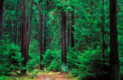
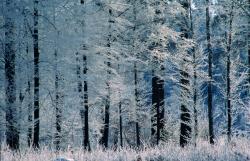
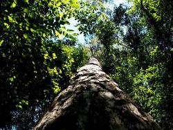
Polish forests
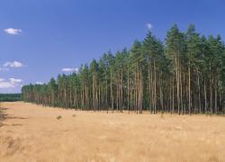 fot. Paweł Fabijański
 fot. Paweł Fabijański
 fot. Paweł Fabijański
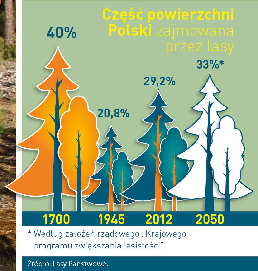
Poland is in the European lead, while concerning the area of all forests. They cover about 29,2 % of the country territory, and grow within the area of 9,1 million hectares. The overwhelming majority of the forests is state owned, of which almost 7,6 million hectares are managed by the State Forests National Forest Holding..
The number of Polish forest is still growing. The forestation rate of the country has increased from 21 % in 1945 to 29,2 % at the moment. Between 1995 and 2008, the forest area increased by 310 thousand ha. The basis for afforestation works is the "National Programme for Increasing the Forest Cover" (KPZL), assuming an increase of the forestation rate up to 30 % by 2020 and up to 33 % by 2050. Polish forests abound in flora, fauna and fungi. 65 % of the total number of animal species live there.
The forests grow in our country on poor soils, mainly because of the development of the agriculture in previous years. It influences the distribution of the types of the forest sites in Poland. Over 55 % of the forest areas is covered with coniferous forests. In other areas, there are forest sites, mainly the mixed ones. Their small part constitute alder and riparian forests – not more than 3 %.
In the years 1945 – 2011 the area of natural deciduous tree stands within the area of the State Forests National Forest Holding increased from 13 to 28,2 %.
Within the lowlands and uplands the most often occurring tee species is pine. It covers 64,3 % of the forest area of the State Forests National Forest Holding and 57,7 % of private and commune forests. In the mountains the predominant species is European spruce ( in the west) and European spruce with beech (in the east). Domination of pine is the result of carrying on sustainable forest management in the past. Once, the monocultures (crops or cultivations of one species) were the answer to the great demand of industry for wood. Such forests appeared to be quite fragile to climatic factors. They also were often the prey of pests' expansion.
In Polish forests, the share of other tree species, especially deciduous trees have been systematically increasing. The foresters have stepped aside from monocultures – that is why, they try to fit specific species of the forest stand to the natural stand, that would be proper for the given area. Thanks to that, in the years 1945 – 2011, the area of the deciduous tree stands within the lands of the State Forests National Forest Holding increased from 13 to 28,2 %. There occur more and more frequently the following tree species: oaks, ashes, maples, sycamore maples, elms, but also birches, beeches, alders, poplars, hornbeams, aspens, tilias and willows.
Our forests are the most often represented by the forest stands aged 40 to 80 years. The average age of the forest equals 60 years. More and more trees are of big size at the age over 80 years. Since the end of the Second World War, the forests' area has increased up to almost 1,85 million hectares.
Raport o stanie lasów w Polsce 2012
Asset Publisher


Asset Publisher
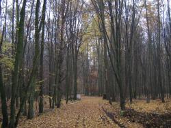
Zasoby leśne
Zasoby leśne

Nadleśnictwo Puławy zarządza gruntami Skarbu Państwa o powierzchni 16,1 tys. ha, w tym gruntami leśnymi o powierzchni 15,6 tys. ha, na terenie czterech powiatów: puławskiego, ryckiego, lubelskiego i opolskiego.
Nadleśnictwo Puławy zarządza gruntami Skarbu Państwa o powierzchni 15,7 tys. haObszar nadleśnictwa położony jest w zasięgu województwa lubelskiego, czterech powiatów: lubelskiego, puławskiego, opolskiego i ryckiego, 18 gmin wiejskich i 7 gmin miejskich – Puławy, Kazimierz Dolny, Ryki, Dęblin, Nałęczów, Konskowola, Kurów. Powierzchnia terytorialnego zasięgu działania nadleśnictwa wynosi ok. 151176 ha. Lesistość obszaru wynosi 22,41%. Lasy własności prywatnej stanowią ok. 40,4% wszystkich lasów znajdujących się w zasięgu działania nadleśnictwa.
Powierzchnia Nadleśnictwa Puławy w powiatach (wg stanu na dzień 31.12.2023 r)
| Powiat | Powierzchnia ogółem (ha) | Powierzchnia leśna (ha) |
| Lubelski | 599 | 540 |
| Opolski | 56 | 56 |
| Puławski | 11603 | 11260 |
| Rycki | 3660 | 3588 |
Pod względem fizjologicznym są to tereny po pograniczu Niziny Mazowieckiej, Wyżyny Lubelskiej i Równiny Radomskiej, rozdzielonych pradolinami Wisły i Wieprza. Takie położenie sprawia, że występują tu bardzo różnorodne formy ukształtowania terenu - od płaskich równin po wysoczyzny pocięte głębokimi wąwozami. Także różnorodna budowa geologiczna sprawia, że tutejsze gleby - a co za tym idzie również szata roślinna - prezentują dużą zmienność i są to biotopy 14 typów siedliskowych lasów niżowych.
Dominującymi typami siedliskowymi w nadleśnictwie są: Bśw 29,79%, LMśw 22,88%, Lśw 19,19% i BMśw 18,61%.
| Typ siedliskowy lasu | Powierzchnia w ha | Udział % |
| Bśw | 4453,63 | 29,79 |
| BMśw | 2783,89 | 18,61 |
| LMśw | 3421,65 | 22,88 |
| Lśw | 2868,75 | 19,19 |
| Ol | 455,64 | 3,05 |
| Pozostałe | 968,31 | 6,48 |
Drzewostany nadleśnictwa tworzą około 33 gatunki drzew, 16 występuje jako gatunki panujące.
Głównym gatunkiem tworzącym drzewostany w nadleśnictwie jest sosna. Drzewostany z panującą sosną zajmują 74,02% powierzchni i dają 74,02% zasobności. Drugim gatunkiem jest dąb. Udział powierzchniowy drzewostanów dębowych wynosi 13,48% a zasobność 15,68%. Kolejnym gatunkiem jest brzoza z udziałem powierzchniowym 8,61% i pod względem zasobności 6,36%. Grab jako gatunek panujący zajmuje 1,65% powierzchni i 1,51% zasobów.
Udział pozostałych gatunków nie przekracza 0,5 % udziału powierzchni leśnej.
| Gat. | Pow.% | Zasob.% |
| So | 74,02 | 74,02 |
| Db | 13,48 | 15,68 |
| Brz | 8,61 | 6,36 |
| Ol | 0,70 | 0,93 |
| Gb | 1,65 | 1,51 |
| Poz. | 1,54 | 1,50 |